 Whiteoak Canyon in Virginia’s Shenandoah National Park gets a lot of love. It usually occupies the “second best” or “second most popular” spot on any given website’s SNP bucket list, giving way to Old Rag (an exciting, rocky, summit climb), or Dark Hollow Falls (a short easy waterfall hike). We must agree. Having done all three of these superlative treks, we might give Whiteoak Canyon top billing – it packs a lot of scenic punch into less than 10 miles, has more variety than either of the other two, and, when paired with the Cedar Run Trail to create a loop, carries equivalent mileage and elevation to the Old Rag hike. Dark Hollow Falls will probably always win a popularity contest; at under a mile and a half and a little over 500 feet of elevation, it is suitable for almost anyone and treats its fans to an impressive 70’ cascade. Whiteoak Canyon, however, presents its guests with four major waterfalls, and hiking the loop adds countless smaller cascades as well as some of the best Blue Ridge Mountain terrain there is. If that isn’t enough, the route is positively teeming with wildlife!
 If you research Whiteoak Canyon online you will find that it is frequently written “White Oak Canyon”. However, the national park website, virginia.org and the trailhead kiosk spell it “Whiteoak”. Yeah, I know, it looks funny to me too, but I decided to place my trust in the National Park Service on this point.
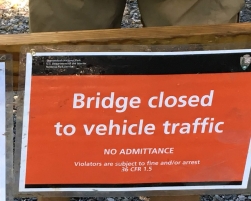
The trailhead can be found in a small parking area at the end of Chad Berry Lane off of Weakley Hollow Road. There is also parking all along the lane but don’t show up late on a beautiful summer Saturday expecting to have much luck parking. As mentioned, this is a wildly popular hike. We arrived (late) at around 9:30am. Fortunately for us, an uncertain weather forecast resulted in a lower than usual turnout that day. As we turned onto Chad Berry Lane, a ranger met us. I rolled down my window, prepared to smugly flash my annual “America the Beautiful” national park pass and be waved through like Prince Harry and Kate Middleton arriving at a benefit. The ranger glanced at my card with a “yeah, yeah” kind of look and stoically announced that due to flooding this hike was “not recommended”.
“Wait. What? Can we still go?”
“We’re not stopping you, but you’ll have to park here and walk to the trailhead …”
“Oh, okay, no problem!” I started to let off the brake.
“… because the bridge is flooded. You’ll have to wade across and the water is moving fast.”
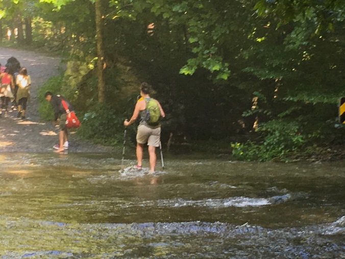
Closer to the camera the water was about 6″ deep and was moving pretty fast
The bridge in question was under several inches of swiftly flowing water. The park service is usually extra careful, particularly at a spot frequented by visitors whose comfort levels with nature vary significantly, but we watched a few people ford the river before attempting it ourselves. We were up for it.
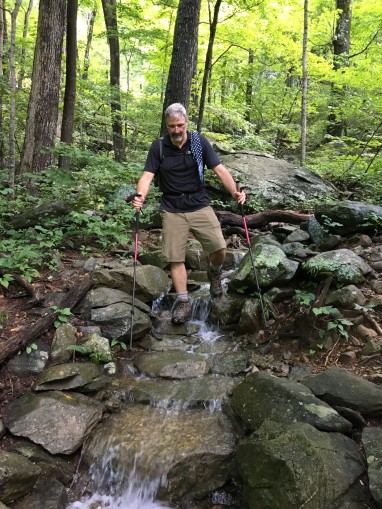
We parked and donned our packs. It had rained here the previous four days. This led to some unusual (for August) and happy circumstances for our planned hike. First, the temperature was relatively mild; we stepped out of the car into sunshine and 78 degrees. Additionally, although the swollen rivers had caused a minor inconvenience with the bridge, we would enjoy flow rates on the Robinson River usually not seen this late in the season. This would make the rapids and waterfalls all the more spectacular. Enthusiastically, we forded the flooded bridge and set off up Chad Berry Lane.
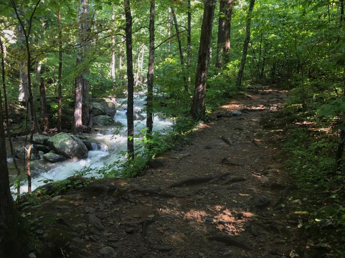
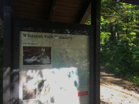
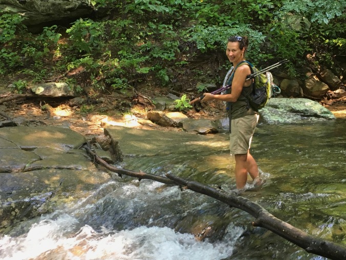
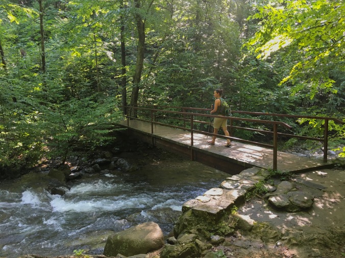 We reached the lower parking lot where a small ranger hut stands a short distance from the trailhead and an information kiosk. We set off up the Cedar Run Trail amidst several other parties. The trail crosses Cedar Run twice in the first quarter mile, both times via steel foot bridges. We watched the swollen river rush underneath and were thankful for the wonders of modern technology. We continued across knowing that we would have make at least three water crossings that day without the benefit of a sturdy, dry, safe bridge.
As we stepped off of the second bridge we stepped in to Shenandoah National Park. Less than 100’ inside the park boundary is a fork in the trail. The Cedar Run Trail bears left, and follows Cedar Run to the west. We would return by this trail several hours later. Straight ahead, and to the north lay the Whiteoak Canyon Trail, at once beckoning us with its tetralogy of tantalizing waterfalls yet resisting with a difficult rocky ascent. Dame Nature beckons, but requires her suitors to prove their worth.
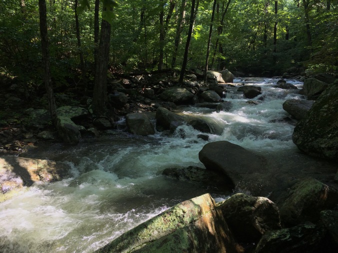 The climb began gently. The air was fresh from a week of rain, and the forest smelled earthy and new. Birds sang in the trees as the sunlight stabbed at the forest floor in thin shafts, made visible by the morning mist. Soon Robinson River was to our left and in rare form. Virtually every twist and turn of the watercourse was churning and frothing, stunningly beautiful in its post storm fury. The trail wound around moss-covered rocks and tall hardwoods, pressing steadily, albeit slowly, upward. The first mile passed painlessly before, at just over a mile and a quarter, we came to our first water crossing.
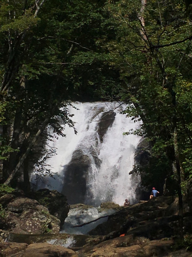
 I had hiked this route before, and this crossing of Tim’s River, a small tributary to Robinson River, was a fairly easy rock-hop. Not today. The rains had swelled the stream so much that we could not even make out where those stepping-stones might have been. Still, it was less than a foot deep and, trekking poles out, we crossed Tim’s River and made our way to the base of the first falls, only a few yards beyond. The National Park Service lists three distinct cataracts here, while most maps just refer to the location as Lower Whiteoak Falls. We only really saw one. Or one and a half (see below). Maybe some bushwhacking is required to see the others. Regardless, Lower Whiteoak Falls glistened in the sun, tumbling 60’ from a wide stone precipice. We did leave the trail to approach the plunge basin where we rested on the rocks and made a friend.
Lower Whiteoak Falls
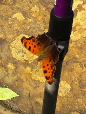 Our respite was punctuated by the appearance of an orange and black Eastern Comma, who paused to enjoy us as we enjoyed the falls. The Eastern Comma is the most common Comma and the friendly insect seemed to think we were an excellent place to alight, landing on each of us in turn and making him or herself right at home. What could be more delightful than sitting in the warm sun at the base of a magnificent waterfall, while butterflies flit around your head and land on your shoulders? Now we know what it was like for Snow White.


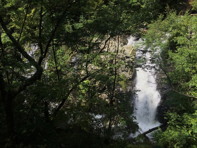
Leaving Lower Whiteoak Falls meant leaving not only our papery-winged friend behind, but also the gentle elevation. We started to climb in earnest now, up steep inclines and uneven stone stairs. We climbed several hundred feet before the trail leveled out and we were treated to a commanding view back down the canyon. We could hear falling water but had hiked far enough upstream that we may have been at the top of an unseen waterfall. Here too were many wildflowers and interesting plants.


 Continuing to climb, we arrived at a cliff face, which, on my last visit, had been gently seeping water. Now the water was running in sheets down the stony face of the crag. The trail was traversing the valley wall well above the river, and water drained from the surrounding peaks in rivulets that crossed, and often ran down, the trail. We were picking our way carefully down one such trail-creek when our path turned sharply to the right. Straight ahead, the creek plunged into nothingness. Approaching the edge, we looked down on another impressive waterfall.
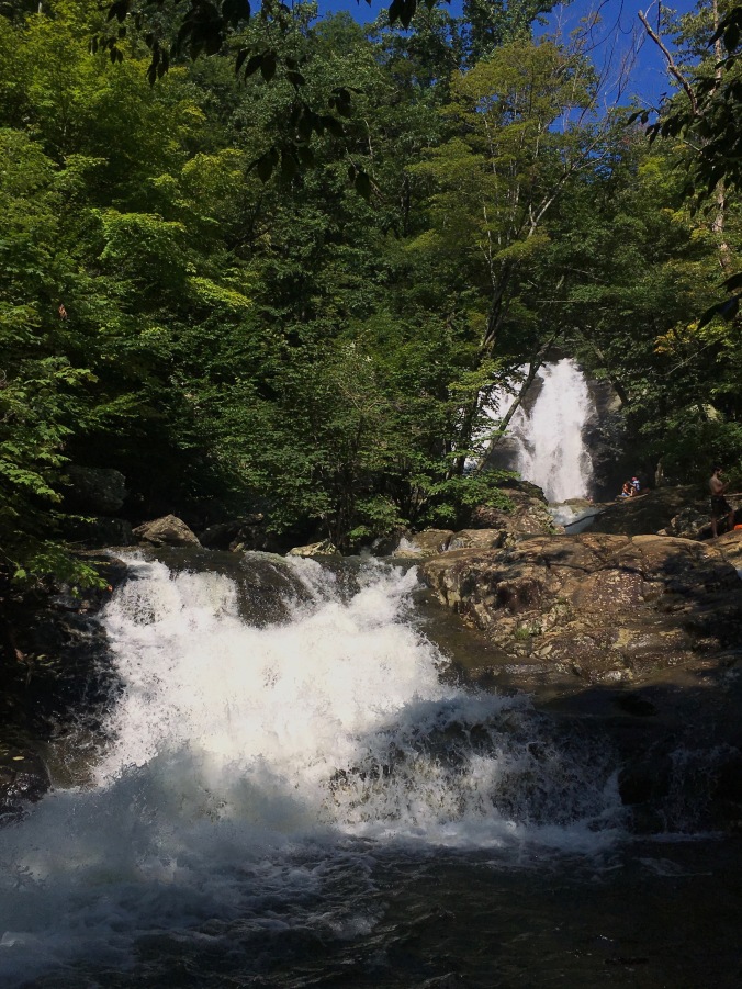
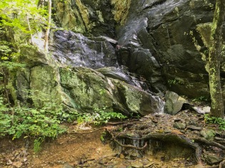
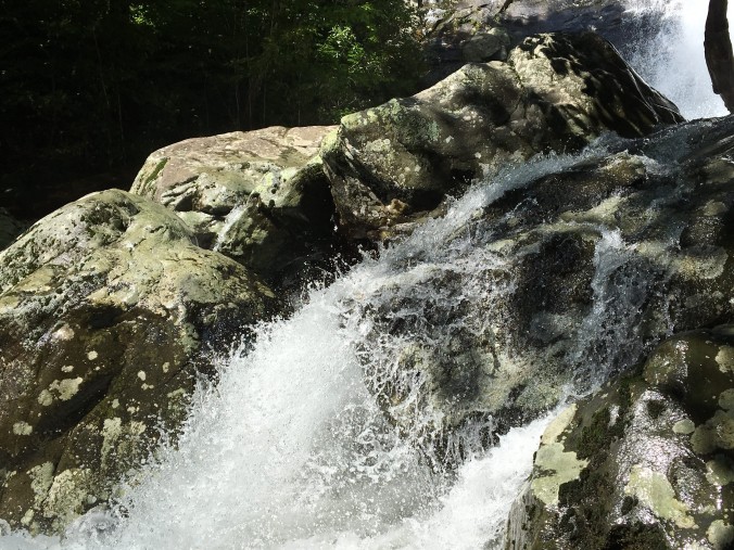
 This is the most downstream chute (or chutes) of Upper Whiteoak Falls and it tumbles 35’ on its trip down the canyon. It is actually several falls, emerging from dense cover in separate places along a wide escarpment, and looking more like a falls one might encounter deep in an Asian jungle, than in rural Virginia. The view was slightly obstructed by foliage but suffers little for it. We ogled it from several vantage points as the trail skirted the cliff, before applying ourselves once more to the ascent. Mere yards up the trail was waterfall number three. Plummeting 62’ in two parts, this was another cataract we could approach, and we did, clambering down off the trail to scramble over the slick rocks at the base. It was great to get close to the thundering falls, but there was no ideal place to rest and the mist from the falls was soaking our clothes. We returned to the trail continuing toward the gem of the canyon: the stunning 86’ section of Upper Whiteoak Falls.
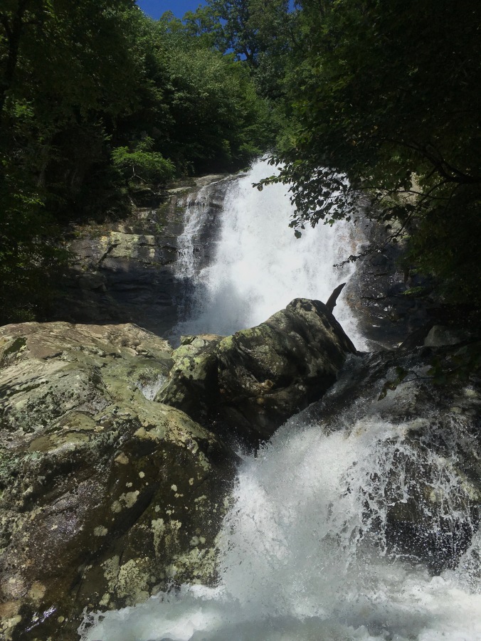
“Lower” Upper Whiteoak Falls
 We had hiked barely over three miles and had gained about 1,200 feet of the 2,450 we would bag that day. We were tired but looking forward to the most spectacular of the Whiteoak’s waterfalls and the magical descent down Cedar Run. Doggedly we pushed upward … ♦
Date: August 4, 2018
Location: Syria, VA
Trailhead: 38.539551, -78.349225
Distance: 9.5 miles (total)
Elevation Gain: 2450 feet
Difficulty: Strenuous
Next week: Waterfalls and Wildlife – Part 2: Cedar Run

What a beautiful are to hike…loved seeing all that green. Everything here in midstate NY is still very white! That comma was so neat! Looks like a great time!
LikeLike
Thanks – Shenandoah National Park is a wonderland I’ve been playing in since I was a child!
LikeLike
Beautiful!
LikeLiked by 1 person
Thanks! I would recommend Whiteoak Canyon to anyone looking for a lot of bang for their hiking buck. It is some of the best that SNP has to offer, and that’s saying something. Cedar Canyon (next week) is pretty fantastic too!
LikeLike
I’m excited to see next week’s post!
LikeLiked by 1 person
Chad Berry Lane is a separate, private driveway adjacent to the Whiteoak Canyon Boundary parking lot. They are two separate entities. Also, the two waterfalls off the Whiteoak Canyon trail (between 1st and 4th going up, there are 6 total) are worthy of a visit for intrepid hikers who don’t mind some non-trivial scrambling. Keep an eye out for poison ivy and snakes in season.
LikeLiked by 1 person
Thanks for this David – I suspected that those other two falls were lurking close by! How does one find them? I’m not sure I understand your information on Chad Berry Lane, and I don’t want to promulgate bad information. On the two occasions I have hiked in from this trailhead I have turned off of Weakley Hollow onto a small lane that ended at the White Oak Canyon Lower Parking Lot. I assumed that was Chad Berry. Google Maps indicates that it is, and so does my navigation app. Can you explain the difference in the entities? Lastly, I did encounter a northern water snake along Cedar Run! I got a pretty good picture that will appear on next Monday’s post. Thanks again for your input.
LikeLike
Pingback: Where the Hell Have I Been? | BIT|Hiker