Just like that river twisting through a dusty land
And when she shines she really shows you all she can
~ Rio, Duran Duran
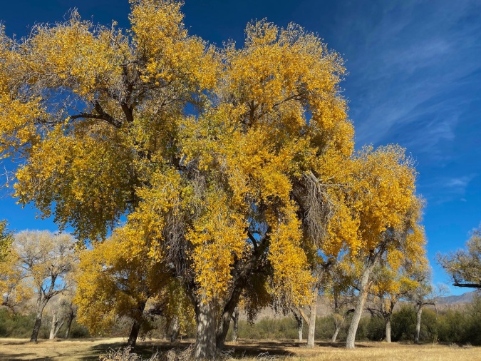 It was mid-afternoon when we pulled into the parking area at Daniels Ranch in Big Bend National Park. The ranch, located about a mile west of Rio Grande Village, is one of the last remaining examples of pioneer farming in the area. There is an adobe farm house there, but the most striking feature of the landscape was the grove of enormous, golden cottonwood trees that stood in a grassy field opposite the parking area. We marveled at the off-season color as we slung on our daypacks before walking farther down Daniels Ranch Road to the trailhead. We were about a hundred yards from the Rio Grande and the U.S.-Mexico border.
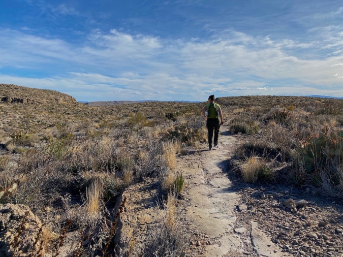
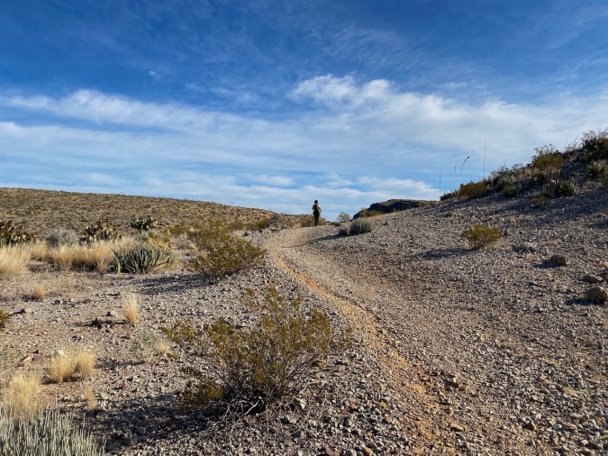
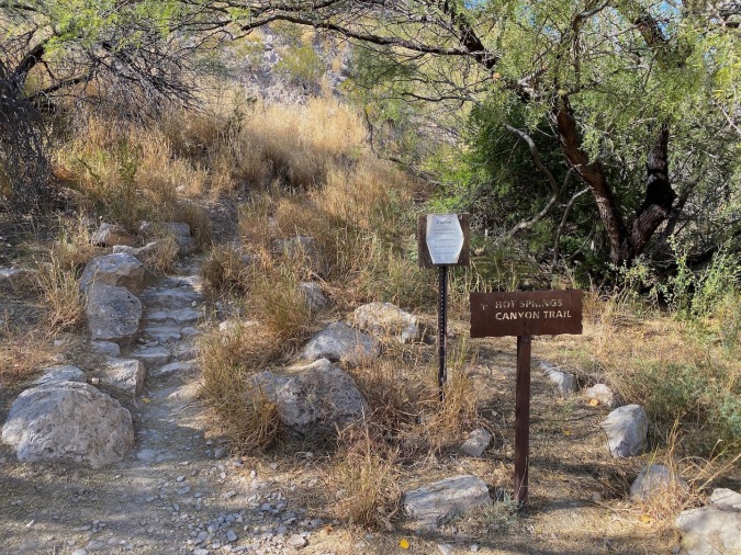 When we gained the trailhead it was marked, both with the rustic metal signs that we had come to expect in this park, and with a printed page warning us that there would be neither (potable) water nor shade on our trek to the spring. We were prepared and set out, uphill, through the south Texas desert.
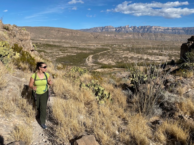
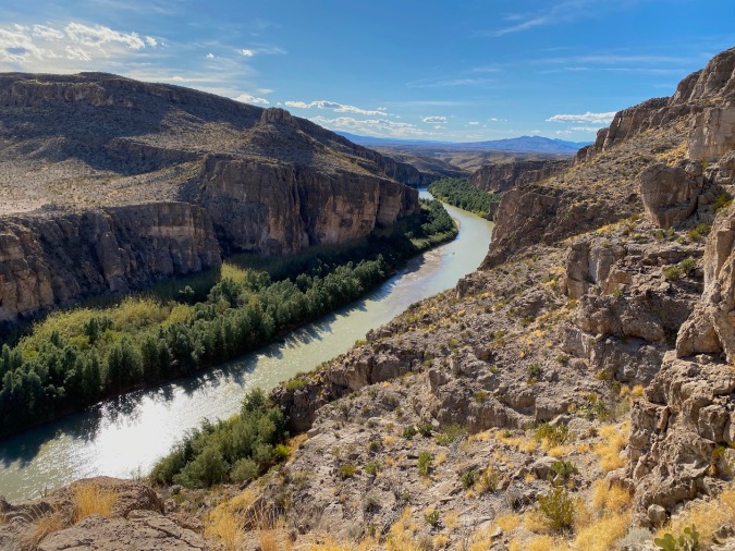
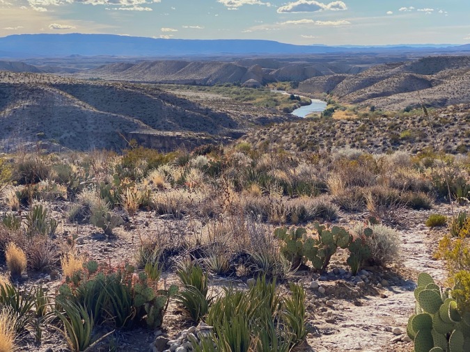
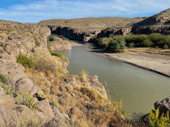
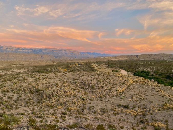
 The first mile of the Hot Springs Canyon Trail is a climb of about 230 feet. Halfway up, we discovered a short spur to a superlative overlook with views up and down the canyon. We took it, and marveled at the view for a few minutes. Mexico stretched off to the south; a wrinkled beige blanket that covered the landscape until it merged with blue-grey mountains in the distance. We continued our climb up (and away) from the river. Lisa expressed some irritation that we were moving inland. A ranger had indicated this hike was “along the Rio Grande”.
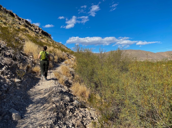
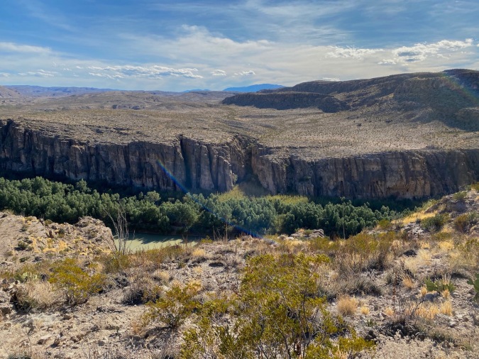
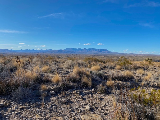
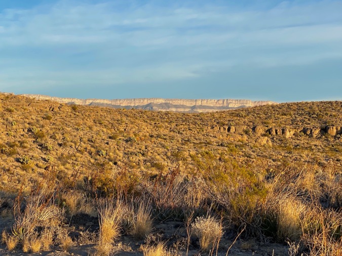
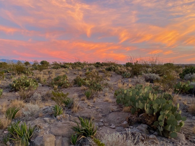
 Full disclosure: once you leave the overlook behind there is almost a mile and a half of trail to cover before the river comes back into view. That mile and a half, however, is a sublime romp through an expansive and extraordinary desert landscape. Deep ravines cut into the dusty hills, and the Chisos Mountains rose up in the distance. Our sandy path threaded among ocotillo, several forms of prickly pear, candelilla, and Texas false agave. This was perhaps the most barren topography we had yet encountered – the flora was lush along the water but on the ridge above the canyon? Little more than scrubby shin-high creosote bushes and stunted succulents. The prickly pears were the largest life forms on the plateau. Despite the badland environs, even Lisa had to admit that the scenery was splendid.
Looking across into Mexico
 After circumnavigating a huge ravine we veered south once more. Soon the waters of the Rio Grande flashed with reflected sunlight, and the trail once again cozied up to the rim of the canyon. We began to descend.
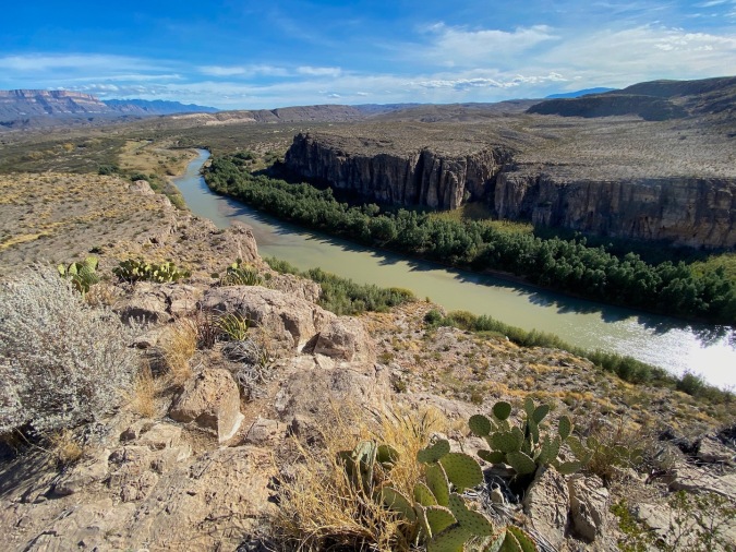
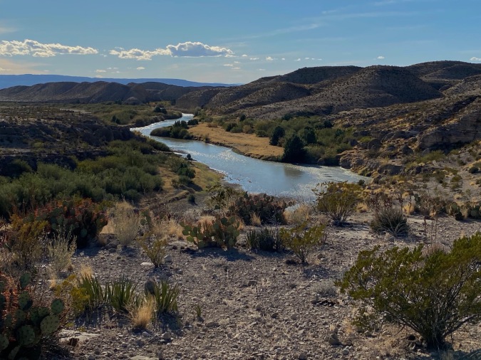
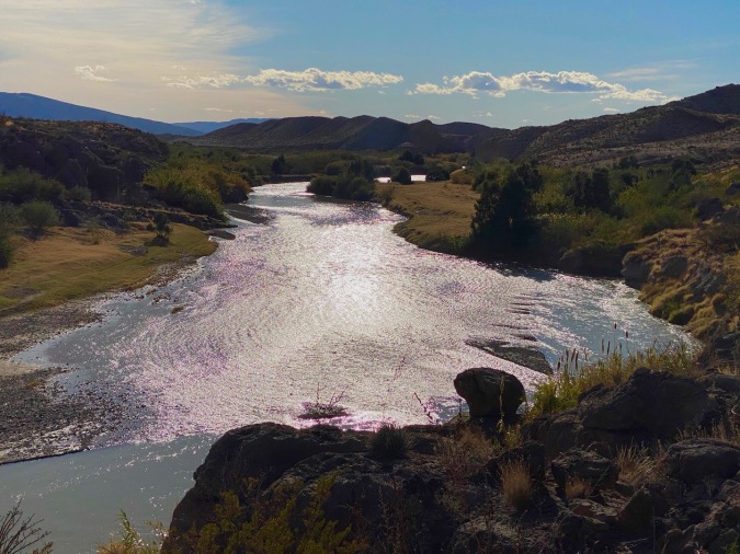
 The trail wound its way down into Hot Springs Canyon, often running right along the edge of the gorge. Ahead, the river was a sparkling ribbon that snaked its way through a landscape stolen from a TV western. Rolling hills of scrub and cactus stretched out to the horizon, while the riverbanks were lush with reeds and trees. Large swards of amber grass broke up the verdant, waterside vegetation, and the water swirled in eddies at bends in the river. We did have to steer away from the water one more time, turning into a boulder-filled coulee, traipsing up the ravine, crossing a deep gully, and then tracking back down the shaded canyon to re-emerge into the bright sunlight on the banks of the Rio Grande. Moments later we were at water level.
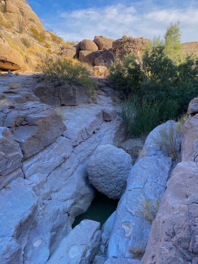
The boulder-filled canyon
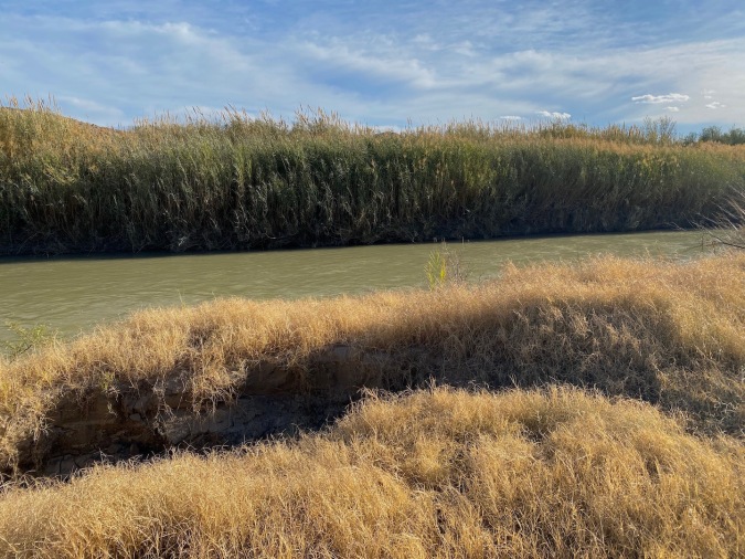
Amber waves of grain for u.s., tall lush reeds for them
We followed the trail along the water for a few hundred yards before coming to the Langford Hot Springs. Joseph Oscar Langford came to southern Texas in 1909 to seek medicinal relief from Malaria. He bought the land around this spring and build a bath house over the fount. Today, nothing but the foundation remains and, as part of the park, the hot spring is open to all. The geothermal water comes out of the ground at 105 degrees, perfect for a mid-hike soak. We quickly shed our shoes and socks.


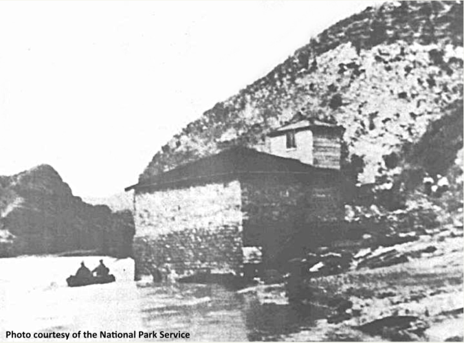
The bath house in its heyday
We shared the twenty by twenty spring with about fifteen others; for better or worse the spring is only 1,500 feet from the Hot Springs Canyon Trail’s western trailhead at the end of Hot Springs Road. It’s easy to get to. Not a can’t-see-it-if-you-don’t-hike-it attraction. We sat on the low, stone wall that divided spring from river, our feet in the spring and the Rio Grand at our back. In sharp contrast to the warm water in the spring, the river felt like ice. We enjoyed the respite for nearly a half an hour, chatting with other bathers. Then, with an eye on the hours of remaining daylight, we dried off and pulled on our socks and shoes. We were five feet down the trail when we heard:
“Hey!” It was that almost comical New York accent. “Are those my Chisos Basin parking lot friends?”
It was Tony from Long Island. We had run into Tony in the parking lot as we prepared for our South Mountain Loop overnighter (read here). This time we were able to extract ourselves in about five minutes, but that was probably because Tony was eager to hit the hot tub. We did ask how his hike went. He rattled off a convoluted tale of getting a late start, getting lost, and climbing Emory Peak in the dark, camping there illegally in tent-razing winds. When we first met Tony he had every piece of gear he owned spread out on the ground around his minivan. In retrospect, that seemed to foreshadow his hiking style. We left him to his much-deserved R&R.
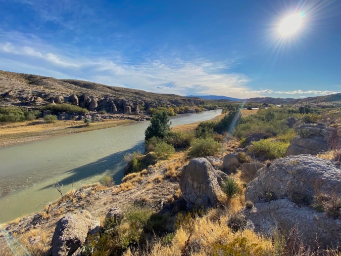
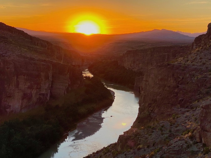
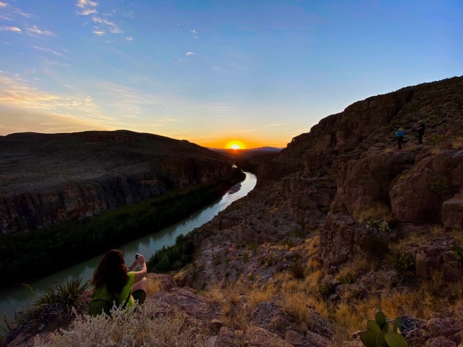
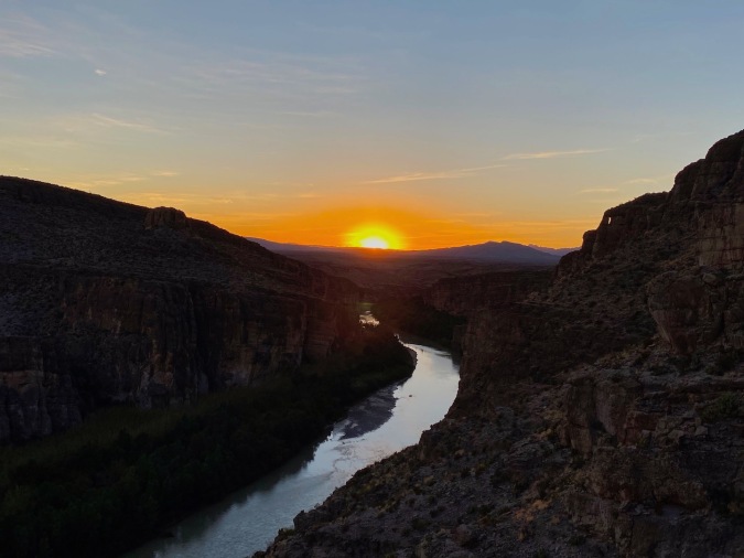
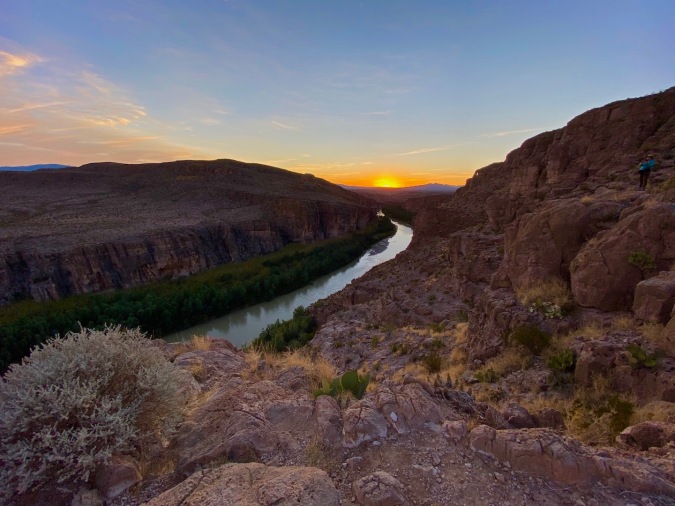
 The hike back was every bit as enjoyable as the hike in; the sun was now at our backs, and as it sank lower in the sky the shadows grew, stretching across the desert landscape. When we reached spur to the overlook the sun was mere moments from kissing the horizon. Taking the spur for the second time, we gained the promontory and settled in to wait for twilight.
Pro Tip: In late December the sun sets directly over the Rio Grande from this vantage point. Don’t miss it! Honestly, this “tip” was actually a happy accident. Even Lisa, the undisputed queen of travel research, was unaware of this tasty kernel of twilit advice.
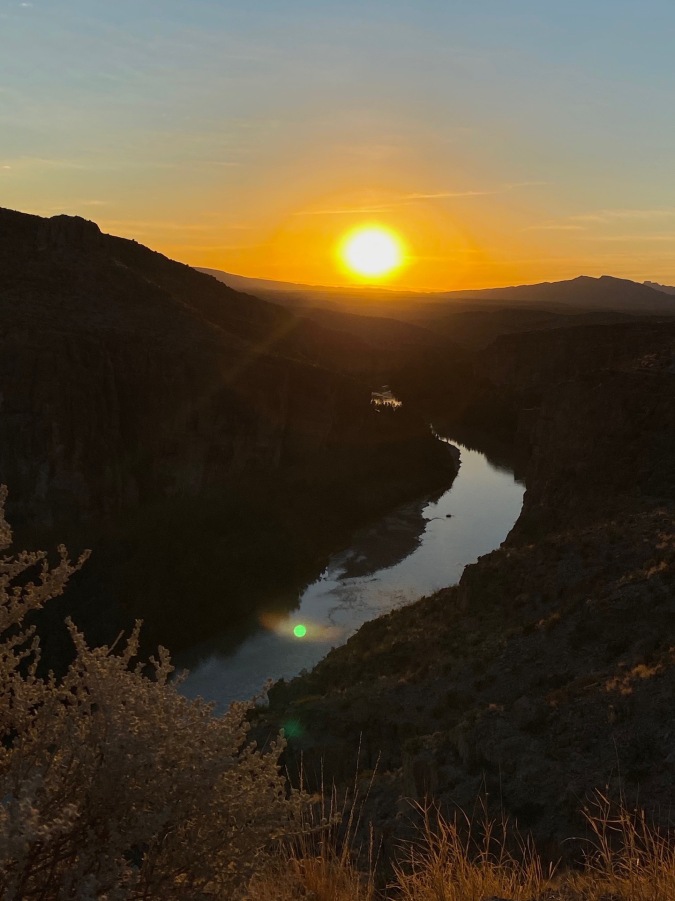 We sat in silent reverence and watched the sun sink ever lower over the river the Spanish called Rio del Norte. When we did speak it was in hushed tones.
 Eventually the sun made its exit, and we solemnly headed for the trailhead. One show had ended; another was just beginning. As we hiked the eastern sky caught fire. Golden amber stained the clouds, and the striations in the Chisos range seemed to luminesce. The alien arms of ocotillo stretched skywards in sharp relief along the trail. We had hurried, not wanting to descend the rocky trail in even semi-darkness. We needn’t have hurried; civil twilight easily covered our fifteen-minute trek out. We were just losing the light as we scuffed our way down Daniels Ranch Road; a silver sliver of moon appearing in the darkening sky.
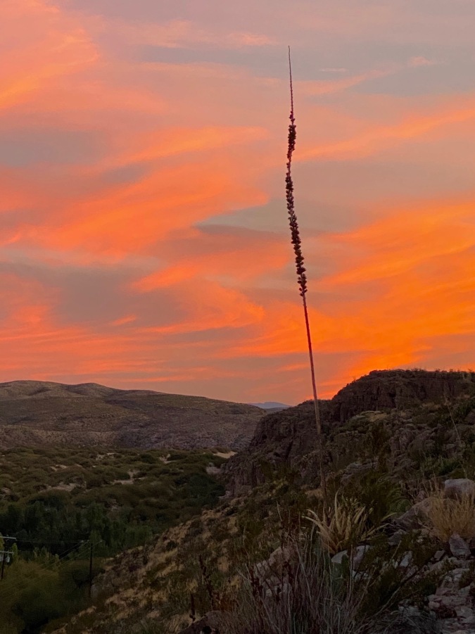
Sotol sunset
This trail really checked all the best boxes for us and earns our recommendation for a not-too-taxing trek in the south Texas desert. At five and a half miles and 712 feet this hike is not going to over-stress a reasonably fit person, and it delivers generously in scenic and historical interest. December is Big Bend’s busiest time and still the park was not at all what we would call crowded. It is important, however, to remember the warnings at the trailhead. There is no water and no shade on this hike. Here, the season is a helper, and we enjoyed a high temperature of 59°F. In the summer months the average is in the mid to upper nineties. Be prepared. We made good use of our water bottles despite the mild temperatures. We also made good use of the hot spring and timed our hike perfectly. And while it may sound like we’re tooting our own horn here, don’t let that stop you from taking our advice. Go in the winter, enjoy the hot spring, and plan to be at the overlook at sunset. We’re pretty sure you won’t regret it! ♦
Date: December 28, 2019
Location: Big Bend National Park, TX
Trailhead: 29.186592, -102.972779
Distance: 5.5 miles
Elevation Gain: 712 feet
Difficulty: Moderate

The views are spectacular for me who lives in Europe
LikeLiked by 1 person
Gorgeous
LikeLiked by 1 person
Pingback: Hot Springs Canyon Trail: Sunset on the Rio Grande — BIT|Hiker – Best of the Midwest – Hiking, nature and photography
Beautiful pictures. I do enjoy these hiking stories.
LikeLiked by 1 person
What a wonderful hike! We’ll definitely have to do this next time in Big Bend. And that sunset was Spectacular!
LikeLiked by 1 person